| Description |
|---|
| Material: | Not Provided |
| Classification: | Not Provided |
| Field Name: | KK820316-4 STA55 RD31 |
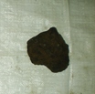
| Description: | 150 kg of pebble to boulder size rock fragments, all fresh and angular surfaces. 1) ~60% is vesicular basalt: of this ~ 40% is ol and/or cpx-rich with large euhedral phenocrysts of cpx and/or ol. A few of the samples are picritic 30% of these also contain plagioclase as a phenocryst together with cpx and olivine; however plagioclase contents are generally <5%. Spinel is a minor constituent in livines ~ 5% of the basalts are plag-pyroxene phyric with ~ 20% plag and 10-15% cpx. these may be transitional to the andesites. 2) ~ 30% andesite to Rhyodacite - one large boulder ~20 kg is holocrystalline Rhyodacite, the andesite contains plag (15%), cpx (10%) and possibly hornblende as phenocrysts in plag-rich groundmass; vesicles < 5%. Rhyodacite are holocrystalline with plag, K-spar, hornblende, qtz and aegirine cpx? less than <10 vesicles, some fragments have a glassy texture. 3) Sedimentary rocks: ~ 10% Epiclastic volcanic sandstones with various igneous clasts visible; pebbly mudstone and gravel; also a silty sand with foram. 1 bag described and 1 undescribed to HIG and Sol Is - also 1 bag with Rhyodacite boulder to HIG. |
| Age (min): | Not Provided |
| Age (max): | Not Provided |
| Collection Method: | Dredge |
| Collection Method Description: | Not Provided |
| Size: | Not Provided |
| Geological Age: | Not Provided |
| Geological Unit: | Not Provided |
| Comment: | Four buckets of samples available each individually labeled 1-3 |
| Purpose: | Geological studies |
| Geolocation |
|---|
| Latitude Start (WGS84): | -8.2128333 |
| Latitude End: | Not Provided |
| Longitude Start (WGS84): | 156.46467 |
| Longitude End: | Not Provided |
| Northing (m) (UTM NAD83): | Not Provided |
| Easting (m) (UTM NAD83): | Not Provided |
| Zone: | Not Provided |
| Vertical Datum: | Not Provided |
| Elevation Start: | Not Provided |
| Elevation End: | Not Provided |
| Nav Type: | Not Provided |
| Physiographic Feature: | Not Provided |
| Name Of Physiographic Feature: | Not Provided |
| Location Description: | Ridge just NW of Simbo. Depth start (m) 2,045. Depth finish (m) 1,635 |
| Locality: | Not Provided |
| Locality Description: | Not Provided |
| Country: | Not Provided |
| State/Province: | Not Provided |
| County: | Not Provided |
| City: | Not Provided |
| Collection |
|---|
| Field Program/Cruise: | KK820316-4 |
| Platform Type: | Not Provided |
| Platform Name: | Not Provided |
| Platform Description: | Not Provided |
| Launch Type: | Not Provided |
| Launch Platform Name: | Not Provided |
| Launch ID: | Not Provided |
| Collector/Chief Scientist: | Not Provided |
| Collector/Chief Scientist Detail: | Not Provided |
| Collection Start Date: | 1982-06-02T04:00:00Z |
| Collection End Date: | Not Provided |
| Curation |
|---|
| Current Archive: | Not Provided |
| Current Archive Contact Details: | Not Provided |
| Original Archive: | Not Provided |
| Original Archive Contact Details: | Not Provided |
| Related Samples |
|---|
Parents: | No Parents | | Siblings: | No Siblings |
| Children: | No Children |
| Relevant Documents: |
|---|
|


 STA55 RD31.JPG (primary image)


